
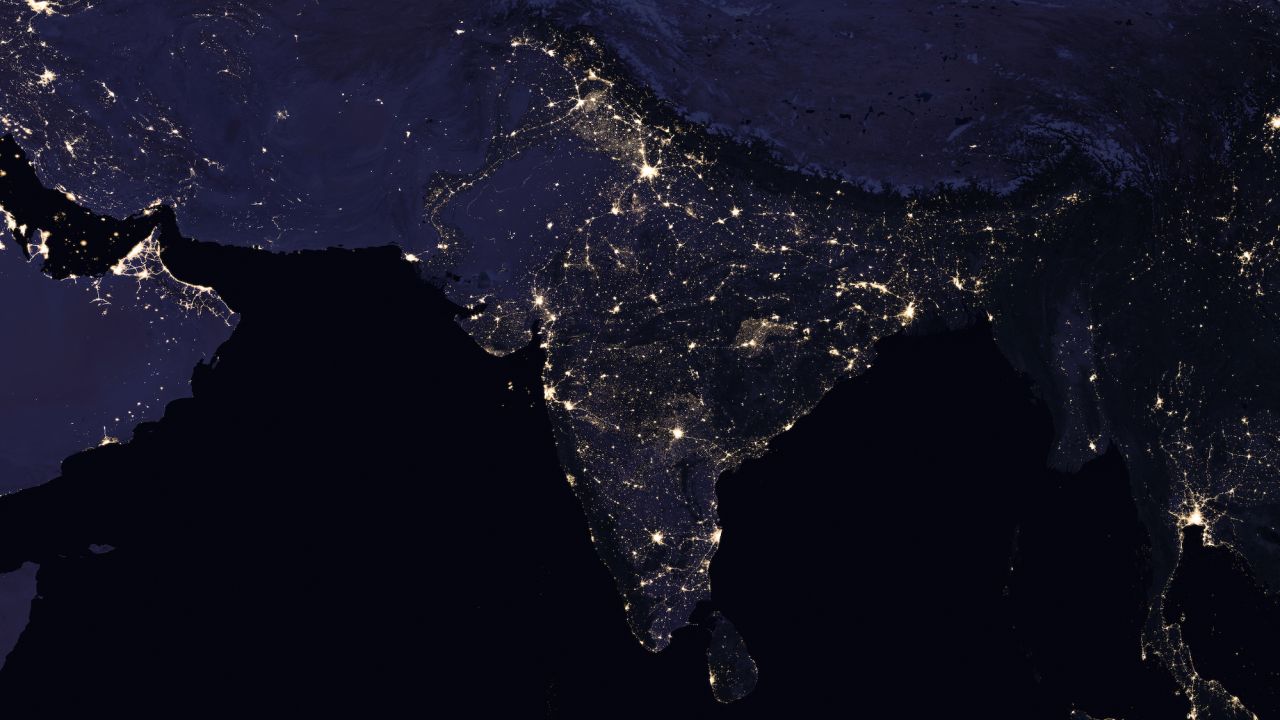
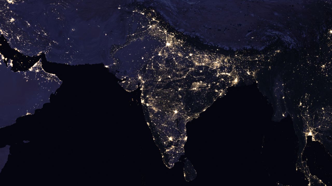
New satellite imagery released Thursday by NASA shows the vast growth of Indian cities in recent years.
Huge swaths of northern India, relatively dark in 2012 night shots, are lit up by huge new urban areas in imagery from 2016.
According to the Oxford Economics Global City Forecast, of the 20 fastest-growing cities in the 2015-19 period, fourteen are in India.
Surat, in north-western Gujarat province, is expected to grow around 10% a year until 2030, “making it the strongest growing city in our global database,” according to Oxford Economics.
Night satellites
The images of India are part of the “Earth at Night” program from NASA’s Goddard Space Flight Center, which aims to provide “the clearest yet composite view of the patterns of human settlement across our planet.”
Satellite images of Earth at night – often referred to as “night lights” – have been a gee-whiz curiosity for the public and a tool for fundamental research for nearly 25 years,” NASA said in a statement.
“They have provided a broad, beautiful picture, showing how humans have shaped the planet and lit up the darkness. Produced every decade or so, such maps have spawned hundreds of pop-culture uses and dozens of economic, social science and environmental research projects.”
Miguel Román, a scientist with the flight center, said his team is able to “monitor cyclical changes driven by reoccurring human activities such as holiday lighting and seasonal migrations.”
“We can also monitor gradual changes driven by urbanization, out-migration, economic changes, and electrification. The fact that we can track all these different aspects at the heart of what defines a city is simply mind-boggling,” he said in a statement.