
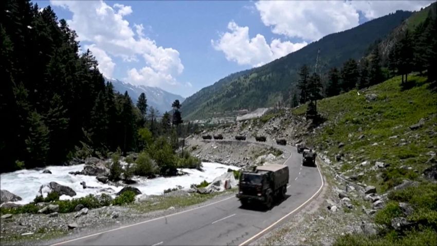


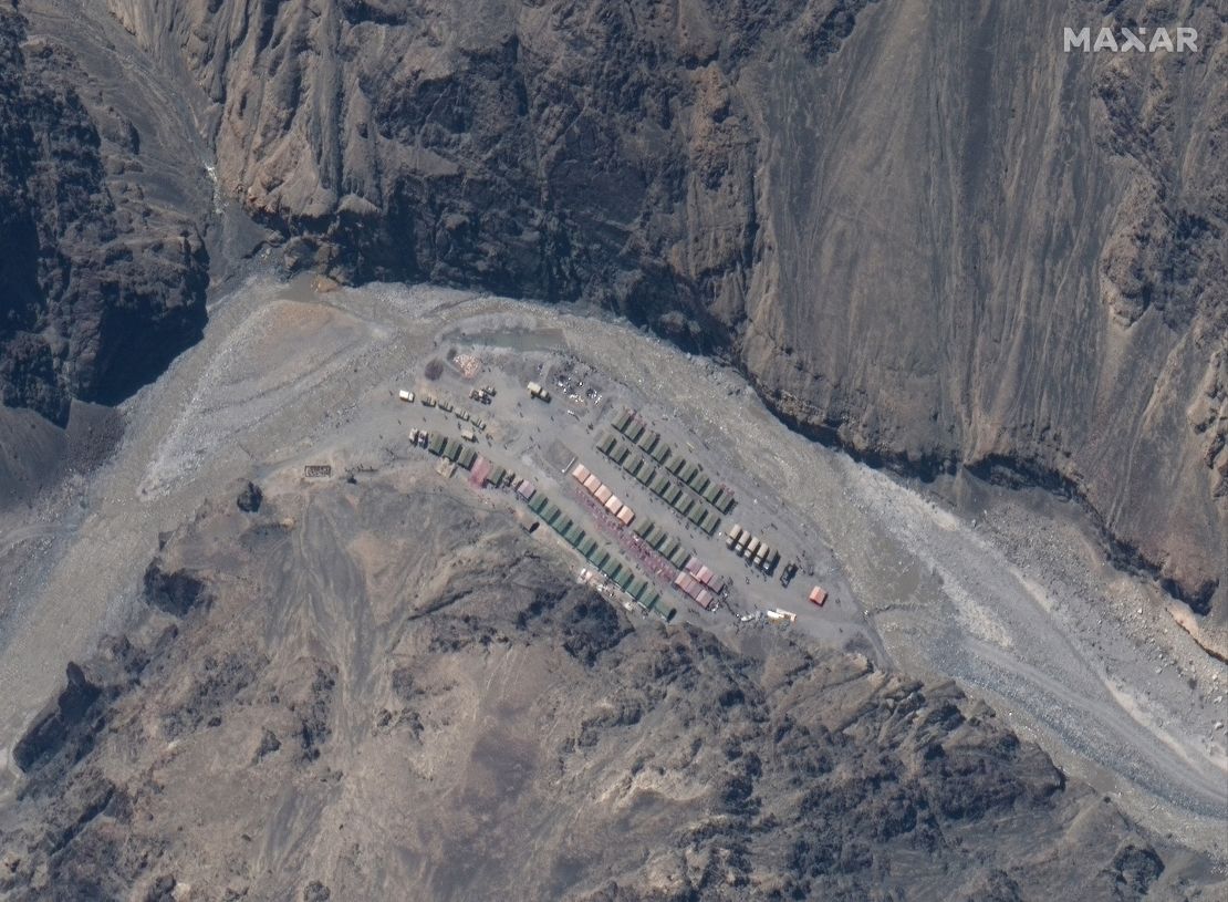
China appears to have rebuilt and expanded a military camp in the Himalayas that was the site of a deadly border clash with India, satellite images show.
The images, from the US satellite operator Maxar Technologies, were taken Monday, a week after what has been described as hand-to-hand fighting with sticks and clubs left at least 20 Indian troops dead.
China has not given any casualty numbers from the clash in a river valley along the Line of Actual Control (LAC), the ill-defined and disputed border between the two powers high in the Himalayan mountains.
Beijing says the deadly clash began when Indian troops crossed into Chinese-controlled territory and tried to dismantle a tent camp erected by Chinese forces in the Galwan Valley at what is known as Patrol Point 14.
The new satellite images appear to show a large expansion of the Chinese encampment on the banks of a river since the fighting on the night of June 15.
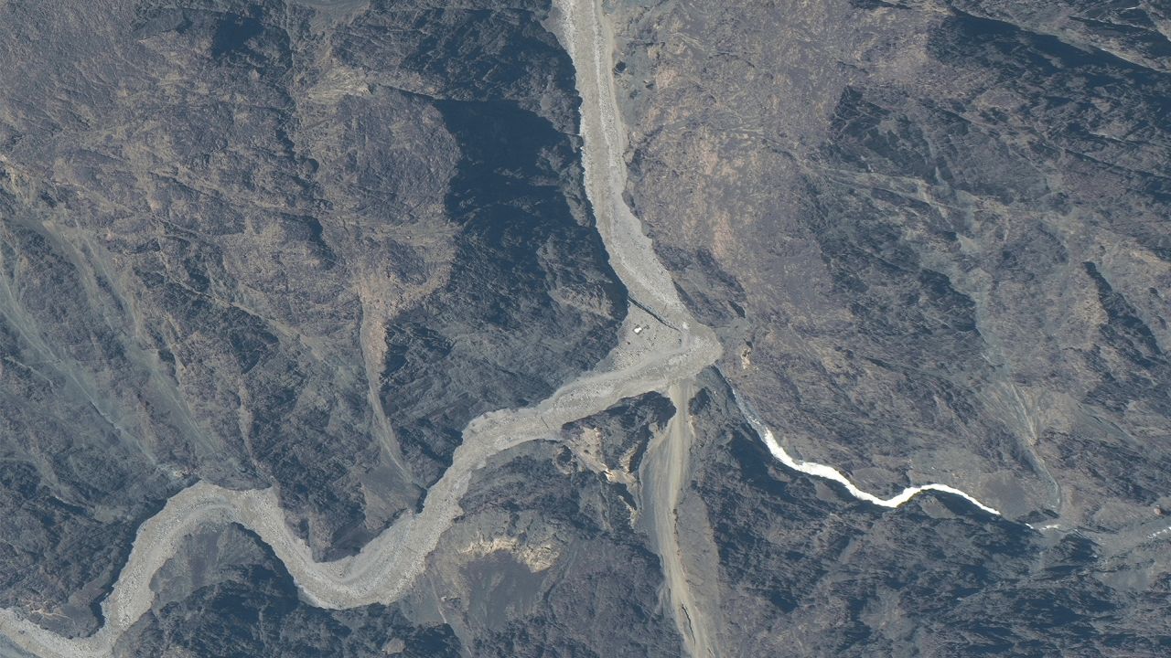
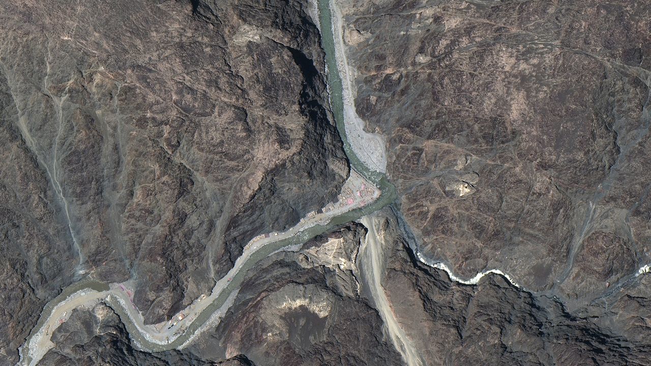
“The small outpost … has grown hugely in size,” Nathan Ruser, a researcher at the Australian Strategic Policy Institute who first shared the images, tweeted on Thursday. “Indian troops aren’t dismantling this one.”
At least one analyst, however, cast doubt on what the images showed.
“It looks to me where someone had camped, and it looks like it was a large camp, but they dismantled it,” said Manoj Joshi, distinguished fellow at the Observer Research Foundation, a New Delhi-based think tank.
Ruser said his analysis of satellite photos showed that since May the number of Chinese troops and vehicles within a kilometer of the border had gone from three to 46 while on the Indian side that number had decreased from 84 to 17.

Tensions continue to run high along the LAC, despite agreement between military leaders after the June 15 incident to defuse the situation.
China said this week that India was entirely to blame for the clash after Indian troops crossed the LAC in violation of an earlier agreement.
“It was shocking that Indian troops publicly violated the agreement, broke their own promise and crossed the LAC to provoke the Chinese side on June 15,” Wu Qian, a spokesman for China’s Defense Ministry, said Wednesday. “When Chinese military troops arrived to negotiate, they were suddenly attacked by Indian troops, and that led to a physical fight between the two sides and caused casualties.”
India’s Ministry of External Affairs responded on Thursday, saying China instigated the deadly clash.
“It has been the Chinese actions thus far which have led to increase in tension in the region and also to the violent face-off of 15th June with casualties,” it said in a statement.
China has been building up forces in the region for more than a month, the ministry said: “At the heart of the matter is that since early May, the Chinese side has been amassing a large contingent of troops and armaments along the LAC.”
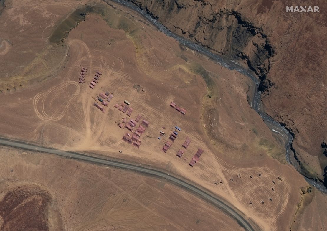
The Maxar satellite photos released this week appear to show China has put a tank company and artillery units at a camp north of Gogra. Another significant base was shown in the Kongka Pass.
Ruser, in an analysis released before the latest satellite photos came out, said previous such photos showed Chinese troops have been regularly crossing the LAC on patrols into Indian territory – although not at the point of the June 15 clash – but that reports of thousands of Chinese troops encamped in Indian territory were unproven.
But he did note that after India started to establish new positions in the Galwan Valley in May, China moved about a thousand troops into the area.
Joshi said China had changed its tactics in the region, from just patrolling disputed areas to occupying them.
“Now the Chinese seem to be indicating this is where the LAC should lie. It’s now no longer a place you patrol but a place you hold,” he said.
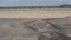
The valley, part of a region claimed as part of Xinjiang by China and Ladakh by India, is cold and inhospitable, draped in snow with temperatures around freezing, even in summer. Located high in the Himalayas, the average altitude is 14,000 feet (4,200 meters), almost double the height where altitude sickness kicks in, meaning any humans in the area have to undergo tedious, gradual acclimatisation or suffer crippling headaches, nausea and fatigue.
India and China went to war over the area in 1962, leaving thousands dead on both sides, and between that month-long conflict and Monday’s skirmish, the region saw numerous fist fights and minor clashes between border guards and outraged statements from Beijing or New Delhi accusing the other of seeking to overstep the de facto border.