
Editor’s Note: CNN Weather produces a weekly column, publishing Mondays, with the weather news you should be aware of as you plan out your week. Find updates each week here. If you enjoy this, sign up to get email updates on significant storms in your inbox.
Millions woke up this morning with a weather whiplash like no other.
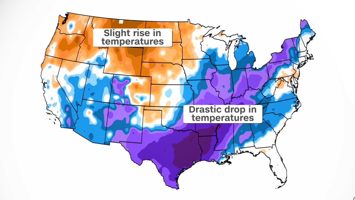
After ringing in the new year in shorts and flip-flops, those same people are in the deep freeze today. Some even went from 80 degree temperatures one day, to snowfall the next day.
Dozens of high temperature records were broken over the weekend. Jacksonville, Florida hit a high of 84 on Sunday, breaking a record. It snowed in parts of the Florida Panhandle Monday morning.
The Okaloosa County Sheriffs department shared a video on Facebook with the caption, “Well how’s this for a temperature change? From 75 degrees at 3 in the afternoon to snow at 3 am.”
Memphis broke a record by hitting 79 degrees, then less than 24 hours later, snow.
“What a difference a day makes,” said the National Weather Service (NWS) office in Memphis. “It has been an eventful few days.”
I don’t think anyone who has been keeping track of the national weather would argue with that.
From historic wind-driven fires in Colorado, to tornadoes across the south, to record warmth, to sub-freezing temperatures, it has been anything but a quiet week.
‘Unbelievable’ - video shows people inside historic Colorado windstorm
The Memphis area woke up this morning with temperatures in the teens.
So to recap: High temperature records broken on Saturday, snow on Sunday, to temperatures in the teens on Monday. WHEW!
They aren’t the only ones feeling the most extreme yin-yang of weather.
In Houston, they had a high of 85 degrees on Saturday, yes, breaking a high temperature record as well, to lows feeling like the 20s this morning when you factor in the wind chill.
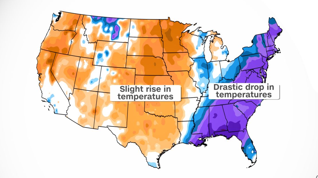
The New York City area broke records on Sunday. LaGuardia had a high of 60, which tied a record. JFK airport broke a record after hitting 59 degrees. By Tuesday morning, they will be in the teens.
Near-record temperatures one day to nearly a foot of snow possible the next
Another one of those places is Washington, DC. They didn’t break a record Sunday, but came close. The high temperature reached 64 degrees at the airport, 3 degrees shy of the record high.
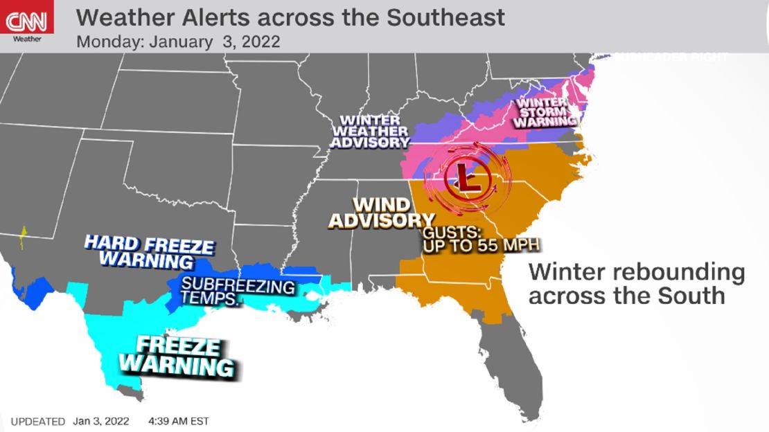
Now they are under a winter storm warning, with up to seven inches of snow expected by the end of the day.
According to the NWS office in Baltimore, the area could see snowfall at one to three inches an hour in some locations, making travel difficult, and winds gusting as high as 30 mph will create blowing snow, making travel even more dangerous.
Washington has been in a bit of a snow drought during the last few years.
The last time DC had any measurable snow was February 2021, and it was only about half an inch. The last time they had more than 2.5” of accumulating snow was in January 2019, more than a thousand days ago.
It was the big snowfall dumping more than 10” in and around the city.
“A dynamic low pressure system will be the fuel for significant weather impacts across parts of the Southeast coast and Mid-Atlantic over the next day or so,” said the Weather Prediction Center (WPC).
This storm system is a fast-mover, but will still have major effects.
“Generally, a swath of between 4-8 inches of snow is possible from the Southern Appalachians through Washington DC and into southern New Jersey by this evening,” the WPC forecast, adding “Localized higher amounts between 8-12 inches are possible.”
Snowfall totals of two to six inches are possible through the Appalachian Mountains.
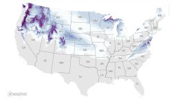
See how much snow is forecast for your area
“Heavy wet snow will also accumulate on power lines leading to power outages,” said the WPC.
This morning there were roughly 500 thousand people who already lost power, and the number will likely go up.
Expect more disruption in travel as well. As the storm moves across the region, flights will be delayed or canceled. This will only put more strain on the airlines who are already canceling flights due to a shortage in staff because of Covid.
Flights will also be disrupted because of the winds, which will gust between 40-45 mph in the Southeast through the day today.
“Refreezing of any melted snow tonight may produce additional hazardous travel conditions,” said the WPC. It will make travel dangerous for Tuesday morning as well, long after the snow has ended.
Lows will drop into the teens and 20s for much of the Southeast and Mid-Atlantic tonight.
Winds won’t be quite as gusty, but there will still be a wind chill for most of the areas, making temperatures feel even cooler by Tuesday morning.
Follow live updates on the East Coast storm here.
Unusual tornadoes strike the south: Why the tornadoes in the South this weekend were so unusual
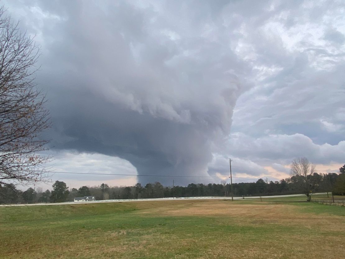
On New Year’s Eve, two confirmed EF1 tornadoes caused damage in Georgia.
Even though Friday’s forecast called for severe storms, including tornadoes, it was a highly unusual event where rare “low precipitation” (LP) supercells generated the tornadoes.
“Low-precipitation storms are very rare in Georgia, or in the eastern US anywhere really, because East of the Mississippi River is so much more humid on average than the Plains. But it does happen from time to time, especially in the cooler season,” said Brandon Miller, CNN Meteorologist.
“Nearly 15 years ago to the day, on January 2, 2006, a similar storm with little rain and a very unremarkable presentation on radar produced an EF-3 tornado in Georgia.”
Such storms are more challenging to see on radar than more “traditional” severe storms. Meteorologists heavily rely on radar reflectivity to monitor where storms are located.
The storm in Carroll County, which includes the northwestern suburbs of Atlanta, and the one in Newton County located between Augusta and Atlanta, both had ideal atmospheric conditions for supercells to develop and form tornadoes, however they were very small in overall size.
While Friday’s tornadoes weren’t EF3’s like the one in 2006, they did cause damage. Click here for more on the damage they caused and how the phenomenon happens.
Remarkable warmth in Alaska

The sun is above the horizon in southern Alaska only six hours a day this time of year, yet one town managed to get all the way up to 67 degrees.
“In late December,” Alaska climatologist Rick Thoman marveled on Twitter. “I would have not thought such a thing possible.”
Click here to see what’s behind the weird weather.
The day it rained fish

And as if the weather hasn’t been bizarre enough this week, it started raining fish in Texarkana.
Click here to read about the crazy phenomenon.
CNN meteorologist Allison Chinchar contributed to this weather column