“You’re always taught to stay away from hurricanes.”
Lieutenant Commander Danielle Varwig says that’s what most pilots would tell you – but she isn’t like most pilots.
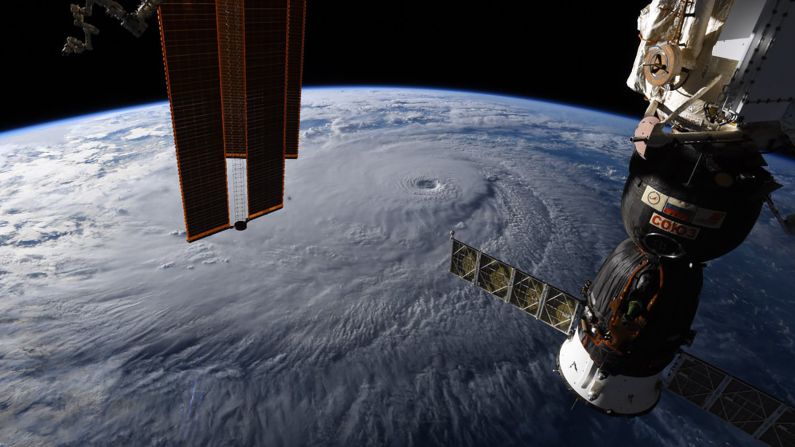
As a hurricane hunter for the US National Oceanic and Atmospheric Administration (NOAA), Varwig spends her working day chasing the eye of the storm.
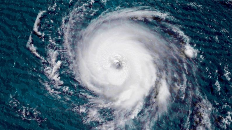
It’s not for the thrills, though. Flying over tropical storms and hurricanes across the Caribbean and Atlantic Basin, Varwig and her team at NOAA collect weather data that can help forecast where and when hurricanes will make landfall.
They say that by putting themselves in danger, they hope to keep others out of it.
“It’s lives at risk. We are doing this to help others on the ground that aren’t able to do this for themselves,” says Varwig.
‘A flying science lab’
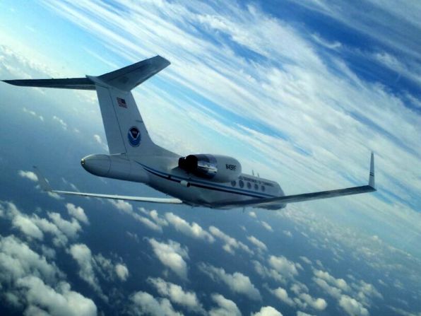
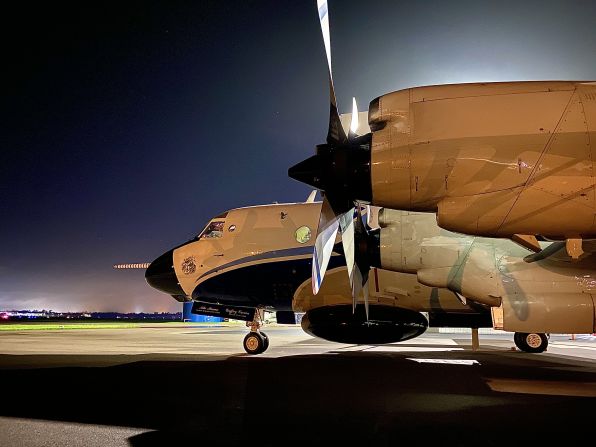
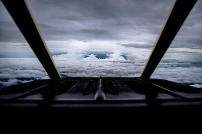
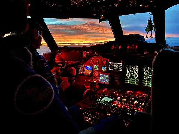
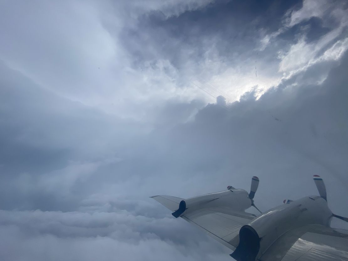
Varwig pilots a Gulfstream IV jet that flies over the hurricane – when skies above the hurricane are clear, she says it’s possible to get a “surreal” bird’s eye vantage point of the whole storm.
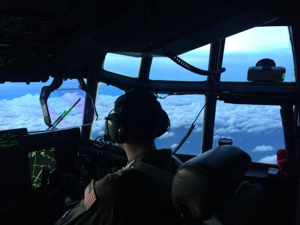
More often than not, though, visibility is poor. “We’re in the clouds, trusting our instruments and flight directors,” says Varwig.
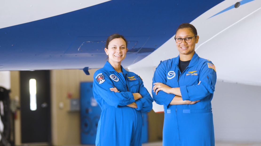
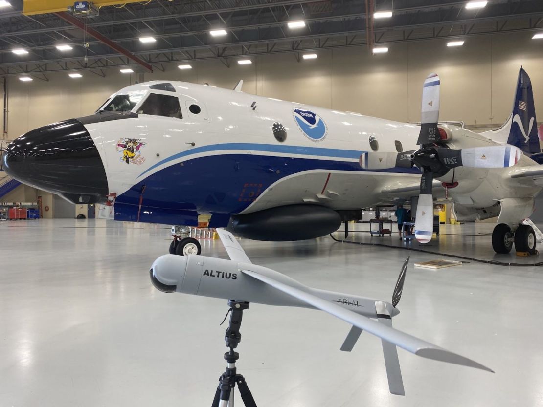
Meteorologist Nikki Hathaway is one of these flight directors. She rides shotgun with Varwig, guiding her through some of the most difficult flying conditions imaginable. Hathaway also accompanies pilots on NOAA’s P-3 Orion planes, which can fly directly into the storm.
These aircraft are “flying science labs” that host up to 18 engineers, data technicians, scientists, and researchers, as well as a variety of tech to help the team gather data, says Hathaway.
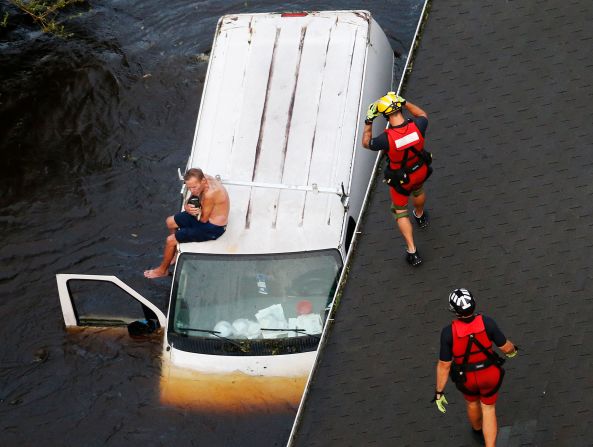
The data “goes back down to the National Hurricane Center,” where it’s used “in real-time to make lifesaving decisions impacting the people on the ground potentially in harm’s way,” says Hathaway.
A key piece of tech is a dropsonde, a device that can be dropped from the aircraft, and will collect weather data such as pressure, temperature, and humidity as it falls to Earth. But a dropsonde can only collect data in a single location, and the meteorologists can’t control it once it’s descending, limiting the range of data they can gather.
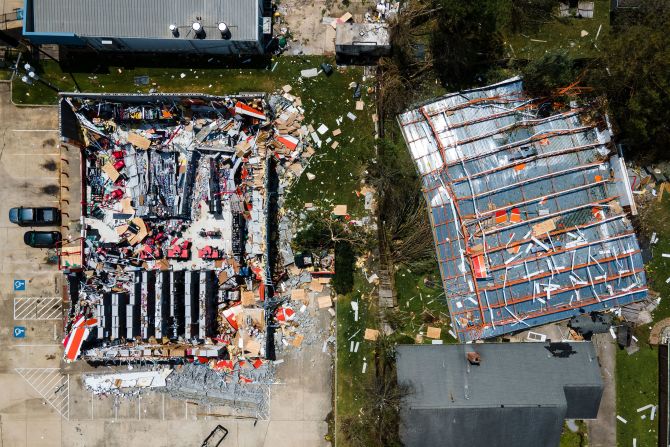
These jaw-dropping photos show the true power of hurricanes
Hurricane-hunting drones
Now, the team is using storm-chasing drones to gather more data than ever before on their hurricane-hunting missions.
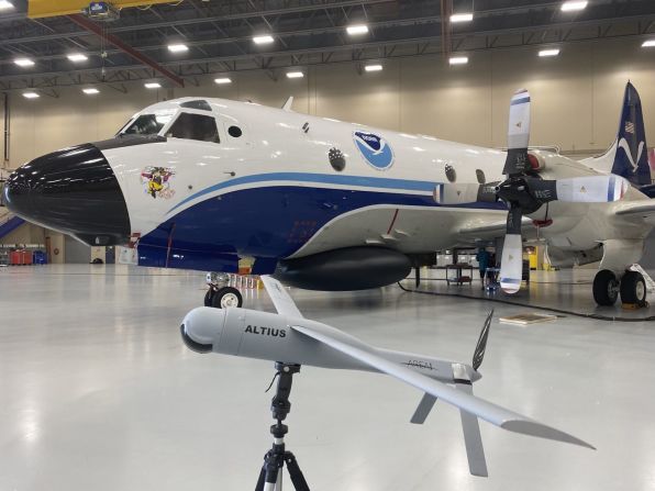
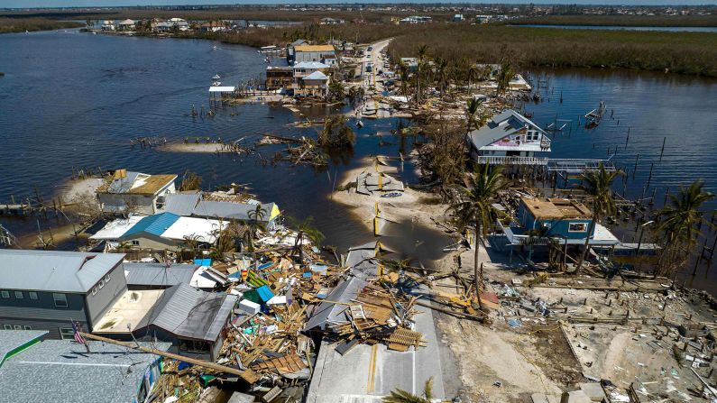
NOAA has been experimenting with the drones, which can be operated remotely, gathering “a totally different scale” of information, says Hathaway. This year, it began testing an unmanned aircraft called Altius, which was deployed during Hurricane Ian in September 2022 – the first hurricane in six years to make landfall in Florida.
With an eight-foot wingspan and weighing just 27 pounds, these drones can fly where the hurricane hunter’s planes cannot. During Hurricane Ian, Altius gathered data on temperature, pressure, and moisture levels in the eye of the storm, as well as circumnavigating the hurricane at various altitudes ranging from 200 feet to 3,000 feet above the water and recording wind speeds that exceeded 216 miles per hour.
The drone can descend to the boundary layer of the hurricane, the part just above the ocean where heat and moisture cause more intense gusts. Gaining information about the turbulence here will help scientists better understand how these storm systems work.
The equipment is still being tested, but Hathaway is excited about how it will improve hurricane modeling and predictions.
“Getting that data in this lowest level (of the storm) is going to be very critical to hurricane forecasting in the future,” she adds.
Pushing boundaries
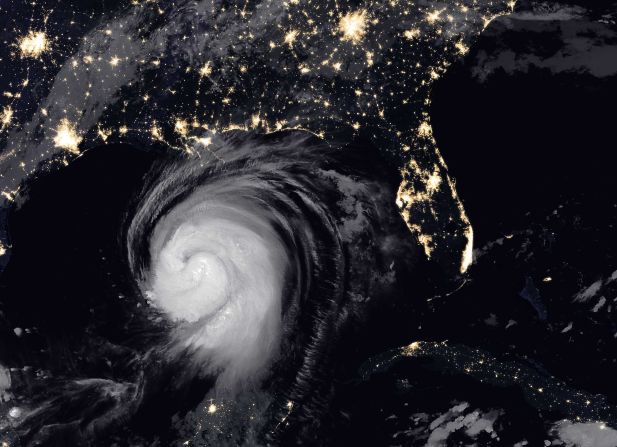
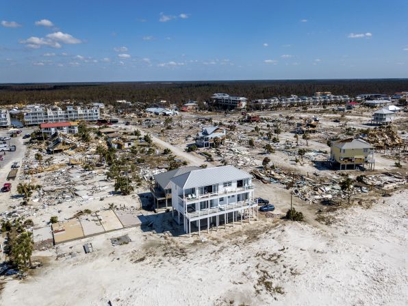
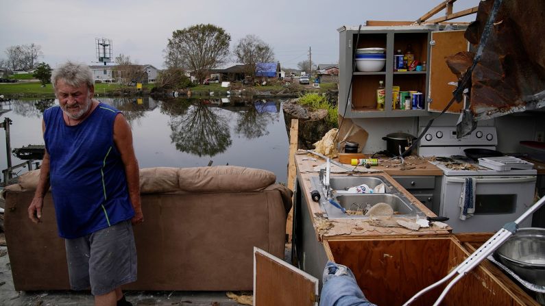
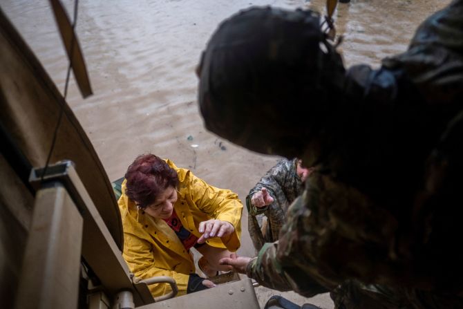
The work of these hurricane hunters is becoming increasingly important – and dangerous – as climate change causes more devastating hurricanes with greater wind speeds and rainfall.
Based in Florida, Hathaway and her team have witnessed first-hand the threat posed by these extreme weather events. When Hurricane Ian hit their state, it generated once-in-a-thousand-years rainfall and water surges, killing at least 125 people.
“When it’s your people, when it’s impacting your home, there’s that extra element of stress in the back of your head,” says Hathaway. Rising sea levels are likely to worsen flooding from storm surges in future events, making NOAA’s predictions ever more vital.
NOAA isn’t just championing technological innovation at home. Earlier this year, the organization embarked on a “groundbreaking mission” to investigate a hurricane nursery off the coast of West Africa, near the Cape Verde Islands, where many of North America’s severe storms start. It was the first time the hurricane hunters crossed the Atlantic – and they hope that by studying storms before they are fully formed, they can greatly improve forecasts and understand their storm tracks better.
As a mother of two, Varwig is keenly aware of the risks she takes – and more motivated to take them. “I do everything for them,” says Varwig of her children.
While Varwig rejects the label of “female pilot,” she’s aware of the scarcity of women in her field – and hopes she can inspire her children and others to pursue their passions.
As a Black woman, “I want to put myself out there to be a role model to little girls, to little Black girls, people who feel like they may be marginalized and not be able to do what I do or anything similar to that,” says Varwig, adding: “I want to make sure that others can look to me and say, ‘Okay, well she’s doing it, then I can too.’”